Assessing earthquake damage in Italy
On 24th August 2016, a Mw 6.2 (USGS) earthquake struck the central region of Italy. Its epicentre was near the village of Accumoli, and the fault rupture length was 25km. Earthquake shaking was felt as far away as Rome (120km south-west), Florence (220km north-west) and Urbino (200km north). However, the worst affected area is the 20km radius around the epicentre, which includes several towns and villages in Umbria, Lazio and Marche.
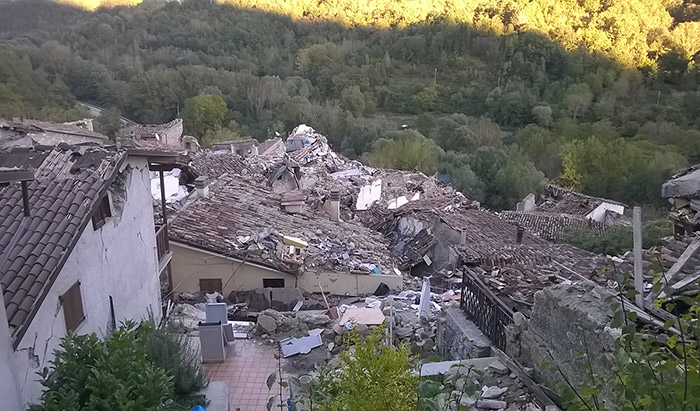
In October, Davide joined the mission organised by the Earthquake Engineering Field Investigation Team (EEFIT) of the UK’s Institution of Structural Engineers (IStructE). EEFIT sent three groups of seismic professionals and academics into the region. The aim was to conduct rapid surveys and investigate the structural damage to buildings and infrastructure, including houses, churches, schools, bridges, etc. The teams also made observations of surface rupture, investigated soil conditions at the accelerometric stations that registered the quake, and documented geotechnical failures.
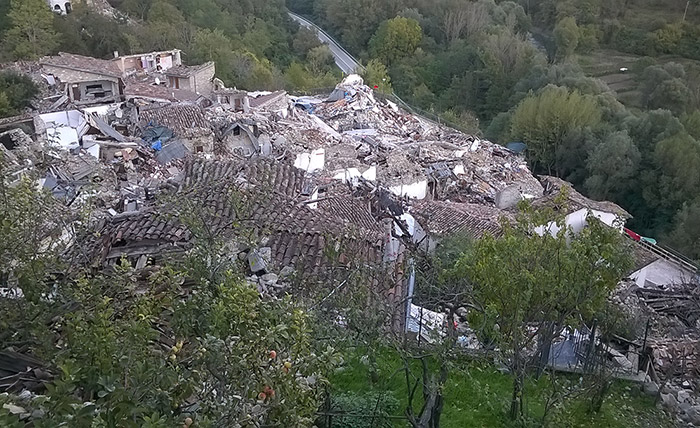
Davide was part of the team that focused on structural engineering aspects. In urban centres, the affected buildings are mainly heritage rubble masonry structures, along with a small proportion of reinforced concrete buildings. He assessed the structural damage to several buildings, of both types, and prepared structural interpretations of what could be seen.
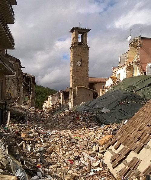
Much of the damage has affected residential buildings, as well as some commercial buildings in towns — most usually masonry heritage buildings. For example, the historic centre of Amatrice (pictured below) has been severely damaged and most of the 298 fatalities caused by the quake occurred here. The level of damage in Amatrice and some other locations is certainly extreme.
The outcome of the teams’ investigations was presented at the IStructE in January.
photos: Davide Pedicone


